WALLIS ANNENBeRG WILDLIFE CROSSING
Agoura Hills, California

TheWallis Annenberg Wildlife Crossing begins with a simple but urgent question: how do we reconnect landscapes divided by infrastructure, and ensure wildlife can move safely through a region shaped by growth and mobility?
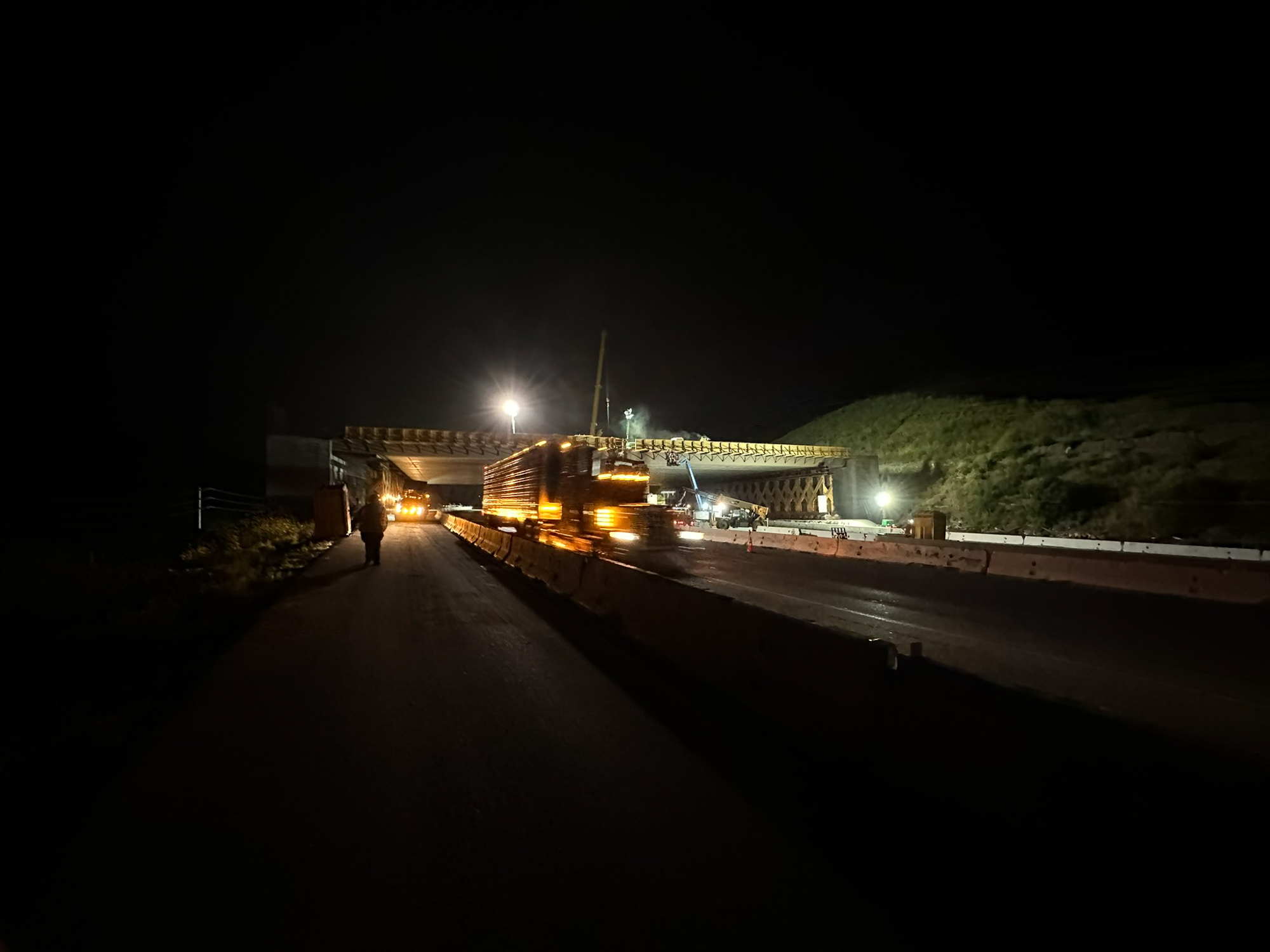
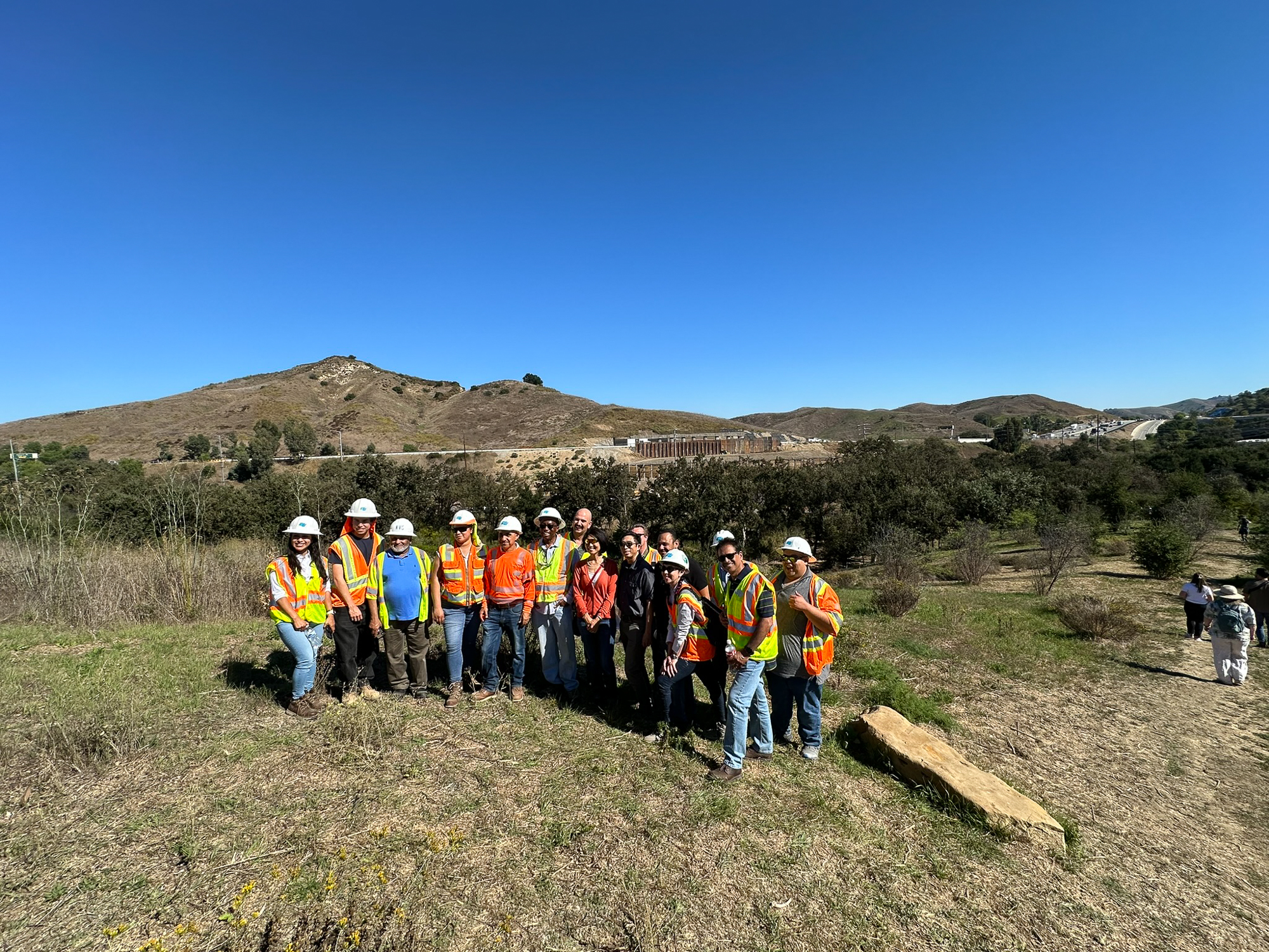
Spanning the 101 Freeway in Agoura Hills, this landmark project is the result of decades of scientific research, advocacy, and collaboration. It represents a shared commitment to restoring ecological connectivity across the Santa Monica Mountains, where one of the last remaining populations of Southern California mountain lions has been increasingly isolated by roads and development.
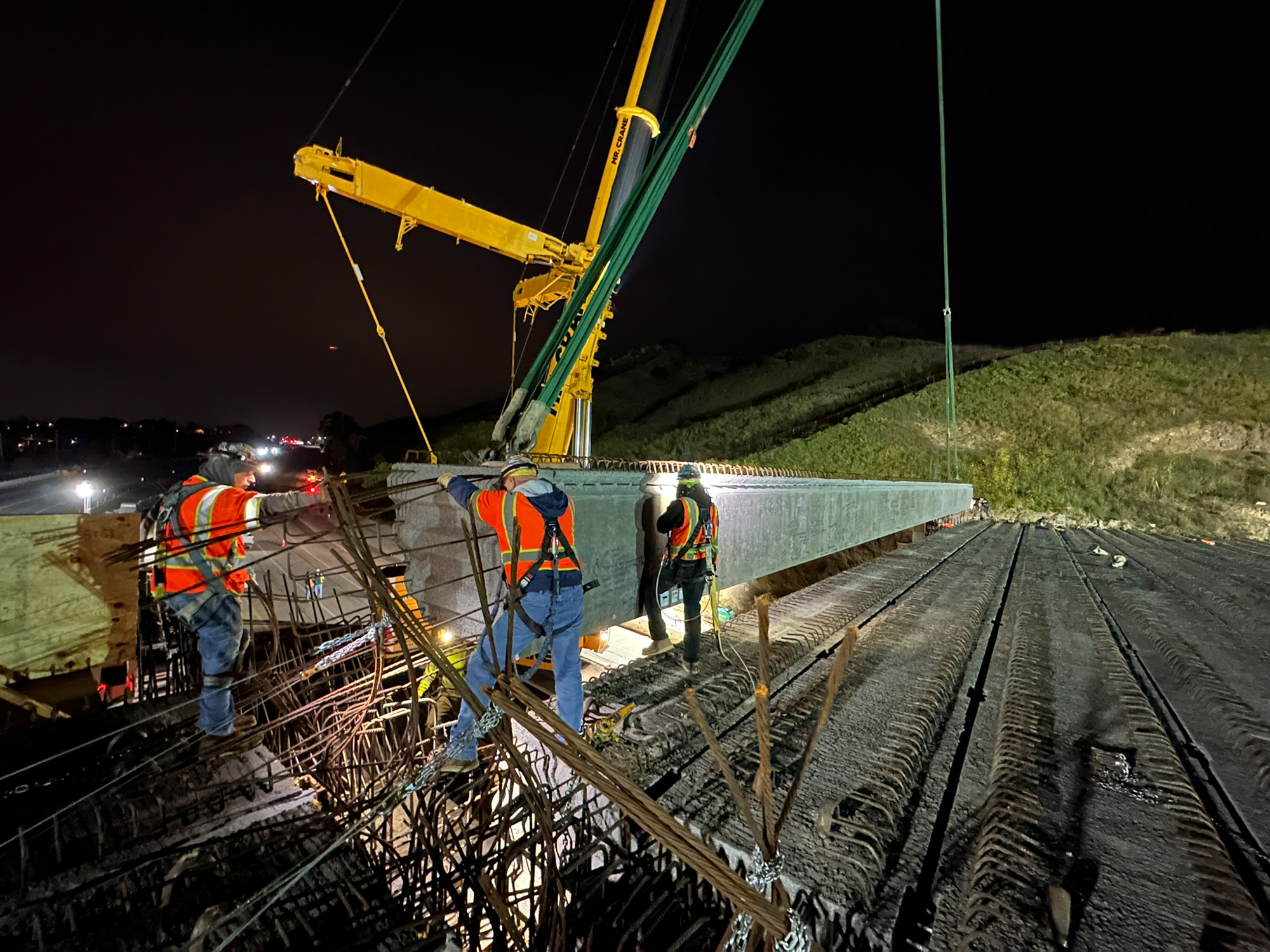
Since 2019, Rock has directed the design of the Wildlife Crossing, first during his tenure at Living Habitats and continuing in his role as President and CEO of Rock Design Associates. Working closely with Caltrans District 7, Rock has led the design effort, collaborated on final engineering drawings, and overseen construction to date. He is currently overseeing Stage 2 and continues to work with the project team through completion. Alongside this work, RDA remains actively engaged in developing outreach and communication materials and collaborating with scientists, researchers, and academic partners to ensure the design reflects the best available knowledge in ecology, wildlife movement, and infrastructure performance.
The crossing brings together engineering, ecology, science, and design into a single piece of living infrastructure. Delivered through a partnership between Caltrans, the Mountains Recreation and Conservation Authority, the National Park Service, the National Wildlife Federation, and the Resource Conservation District of the Santa Monica Mountains, the project has been described by many as one of the most hopeful infrastructure efforts underway anywhere in the world.
The urgency behind this work is embodied by P-22, the mountain lion who became an international symbol of resilience after navigating freeways to make a home in Griffith Park. Although P-22 passed away in December 2022, his story helped galvanize public support for safer wildlife movement. The Wallis Annenberg Wildlife Crossing stands as part of that legacy, designed to provide connected habitat for mountain lions and countless other species, and to demonstrate how thoughtful infrastructure can repair what fragmentation has broken.
The Wallis Annenberg Wildlife Crossing begins with a simple but urgent question: how do we reconnect landscapes divided by infrastructure, and ensure wildlife can move safely through a region shaped by growth and mobility?
Spanning the 101 Freeway in Agoura Hills, this landmark project is the result of decades of scientific research, advocacy, and collaboration. It represents a shared commitment to restoring ecological connectivity across the Santa Monica Mountains, where one of the last remaining populations of Southern California mountain lions has been increasingly isolated by roads and development.
Since 2019, Rock has directed the design of the Wildlife Crossing, first during his tenure at Living Habitats and continuing in his role as President and CEO of Rock Design Associates. Working closely with Caltrans District 7, Rock has led the design effort, collaborated on final engineering drawings, and overseen construction to date. He is currently overseeing Stage 2 and continues to work with the project team through completion. Alongside this work, RDA remains actively engaged in developing outreach and communication materials and collaborating with scientists, researchers, and academic partners to ensure the design reflects the best available knowledge in ecology, wildlife movement, and infrastructure performance.
The crossing brings together engineering, ecology, science, and design into a single piece of living infrastructure. Delivered through a partnership between Caltrans, the Mountains Recreation and Conservation Authority, the National Park Service, the National Wildlife Federation, and the Resource Conservation District of the Santa Monica Mountains, the project has been described by many as one of the most hopeful infrastructure efforts underway anywhere in the world.
The urgency behind this work is embodied by P-22, the mountain lion who became an international symbol of resilience after navigating freeways to make a home in Griffith Park. Although P-22 passed away in December 2022, his story helped galvanize public support for safer wildlife movement. The Wallis Annenberg Wildlife Crossing stands as part of that legacy, designed to provide connected habitat for mountain lions and countless other species, and to demonstrate how thoughtful infrastructure can repair what fragmentation has broken.
WALLIS ANNENBeRG WILDLIFE CROSSING
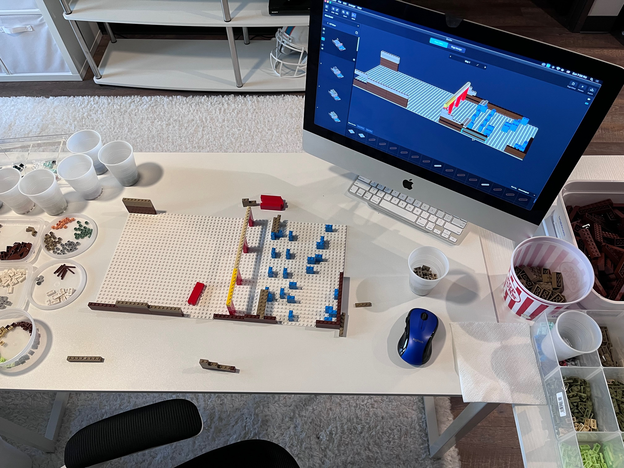
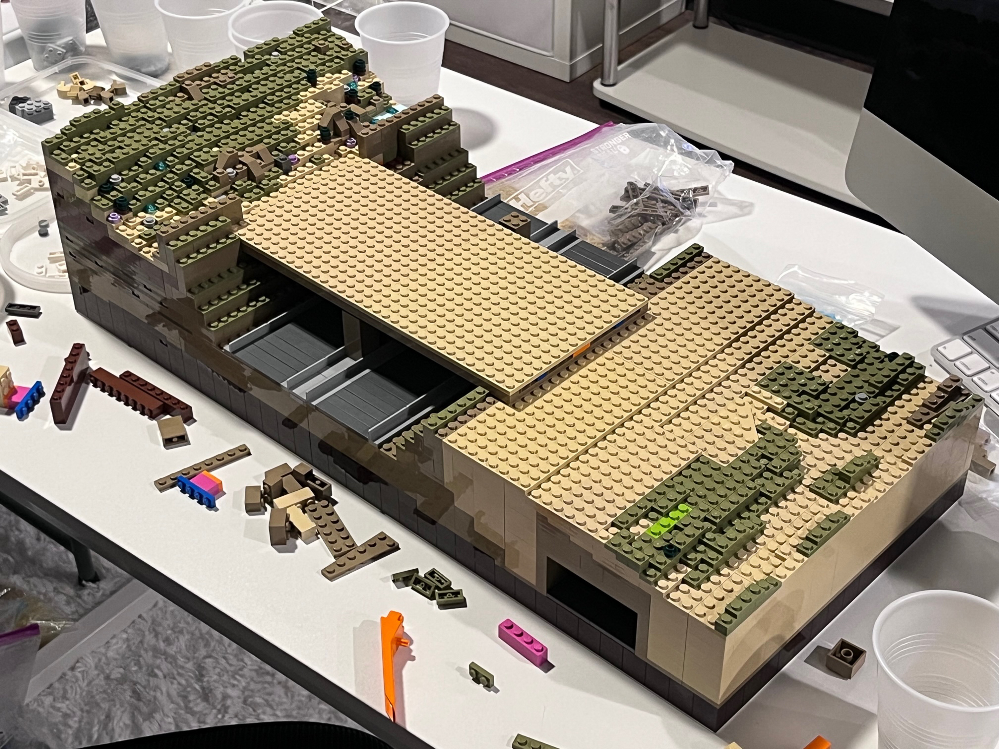
LEGO® BUILD
LEGO IDEAS® Competition Entry 2023

This LEGO project began as an experiment in storytelling.
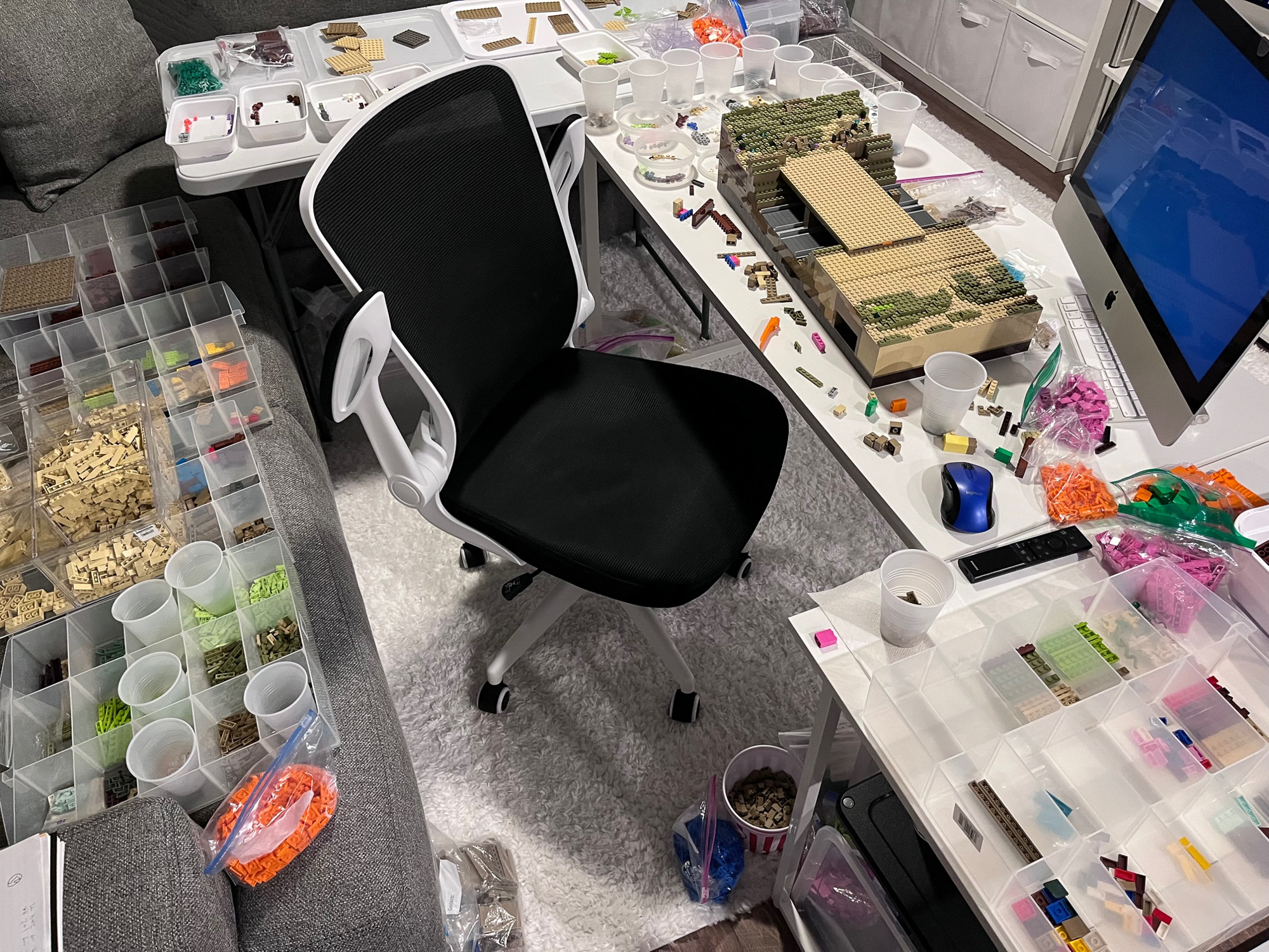
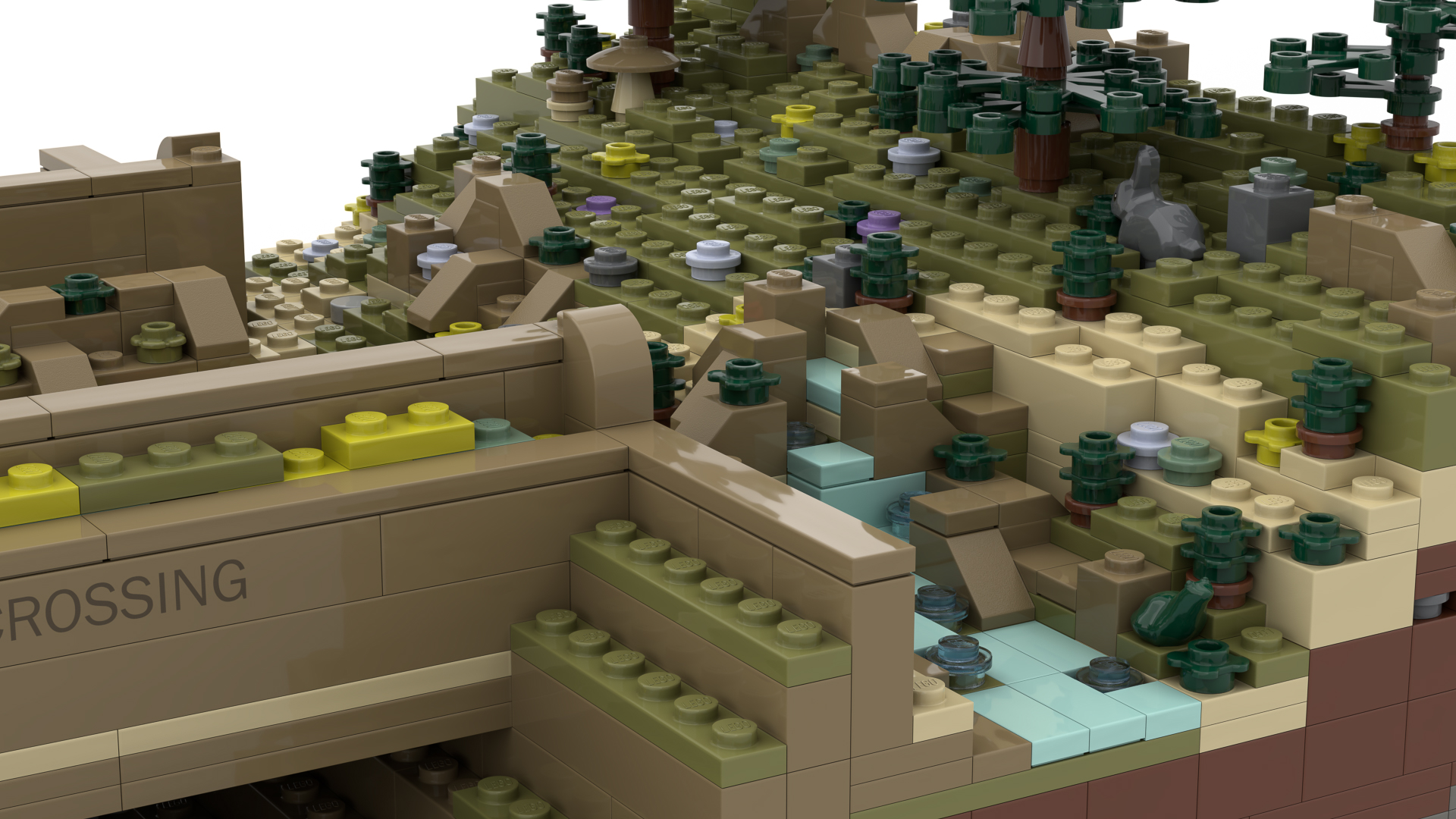
Imagined by Rock as a playful way to convey the importance of wildlife connectivity and spark curiosity across generations, the model is inspired by the Wallis Annenberg Wildlife Crossing in Southern California. Using LEGO bricks as a shared language of creativity, the project invites people of all ages to see how landscape architecture can bridge imagination, infrastructure, and ecology.
The Wildlife Crossing is brought to life at a miniature scale, complete with thoughtfully designed minifigures representing the wildlife species the crossing is intended to serve. Through this lens, a complex piece of ecological infrastructure becomes accessible, tactile, and joyful, offering a new way to understand how design can support coexistence between people, wildlife, and the landscapes they share.
Robert Rock created the project in collaboration with LEGO artist Martin Egemo, also known as TMX Brick Notes, while at Living Habitats. Although the LEGO Ideas® competition has concluded, the project remains a testament to the power of play as a tool for education, advocacy, and connection.
This LEGO project began as an experiment in storytelling.
Imagined by Rock as a playful way to convey the importance of wildlife connectivity and spark curiosity across generations, the model is inspired by the Wallis Annenberg Wildlife Crossing in Southern California. Using LEGO bricks as a shared language of creativity, the project invites people of all ages to see how landscape architecture can bridge imagination, infrastructure, and ecology.
The Wildlife Crossing is brought to life at a miniature scale, complete with thoughtfully designed minifigures representing the wildlife species the crossing is intended to serve. Through this lens, a complex piece of ecological infrastructure becomes accessible, tactile, and joyful, offering a new way to understand how design can support coexistence between people, wildlife, and the landscapes they share.
Robert Rock created the project in collaboration with LEGO artist Martin Egemo, also known as TMX Brick Notes, while at Living Habitats. Although the LEGO Ideas® competition has concluded, the project remains a testament to the power of play as a tool for education, advocacy, and connection.
vision for
ROBBINS master plan & robbins STORMWATER PARK
Robbins, Illinois

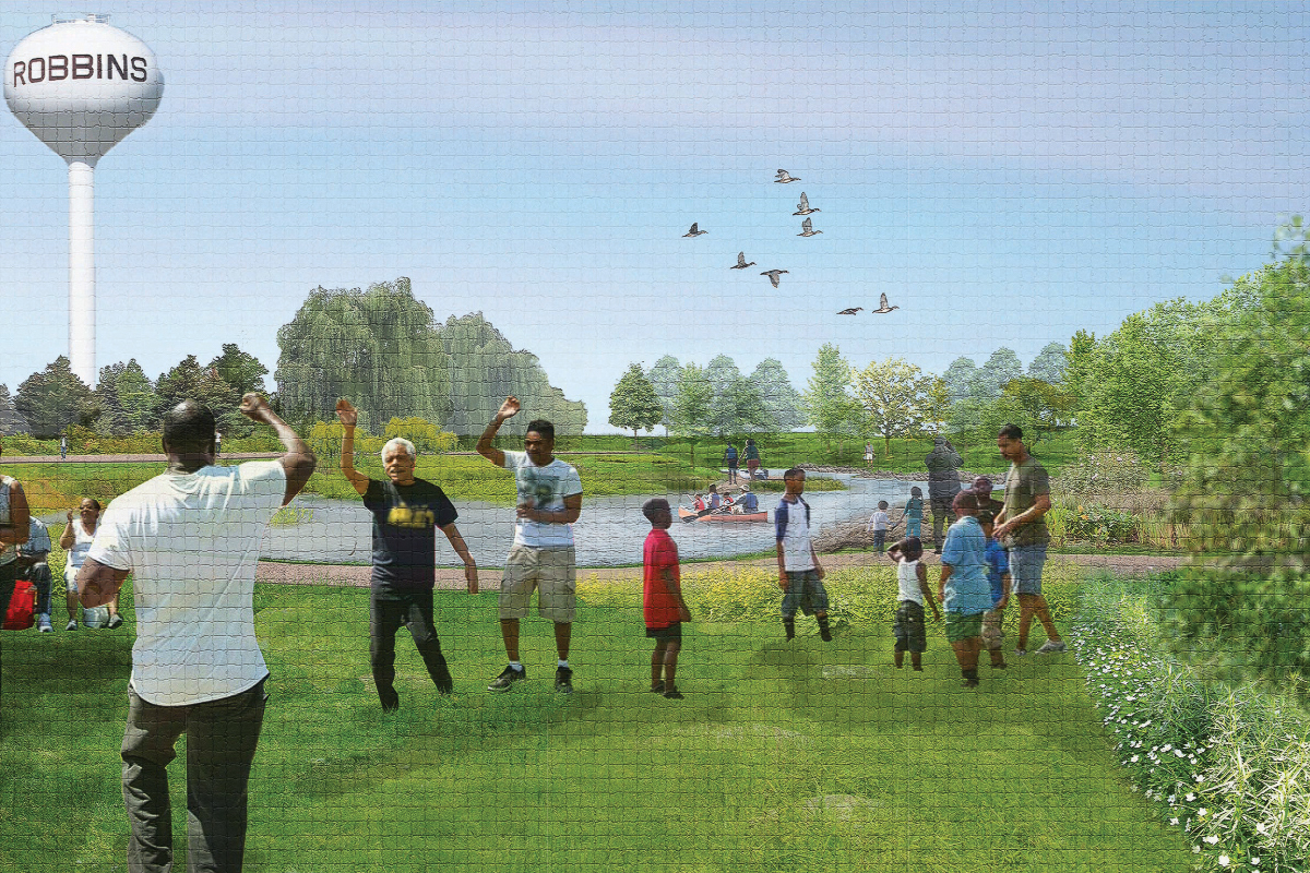
The Vision for Robbins Master Plan responds to a long history of flooding and disinvestment in the Village of Robbins, a historically self-governed Black community located within a low-lying floodplain south of Chicago. For decades, Robbins relied on infrastructure that could handle only modest rainfall. As storms grew heavier, flooding became a regular part of daily life.
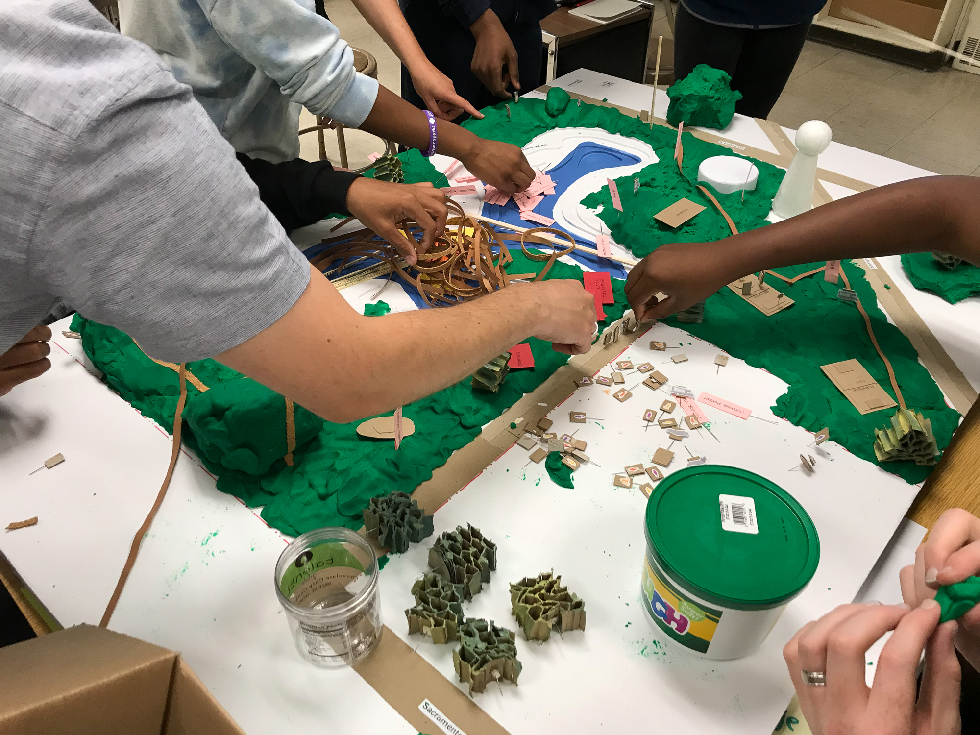
Through a series of public meetings, collaboration with residents, and ongoing dialogue with local leadership, the planning team developed a vision that paired critical stormwater infrastructure with long-term community opportunity. The master plan leveraged green infrastructure to address flooding without displacing residents, while identifying future possibilities for transit-oriented development near the METRA station and an energy district along the Cal-Sag Channel.
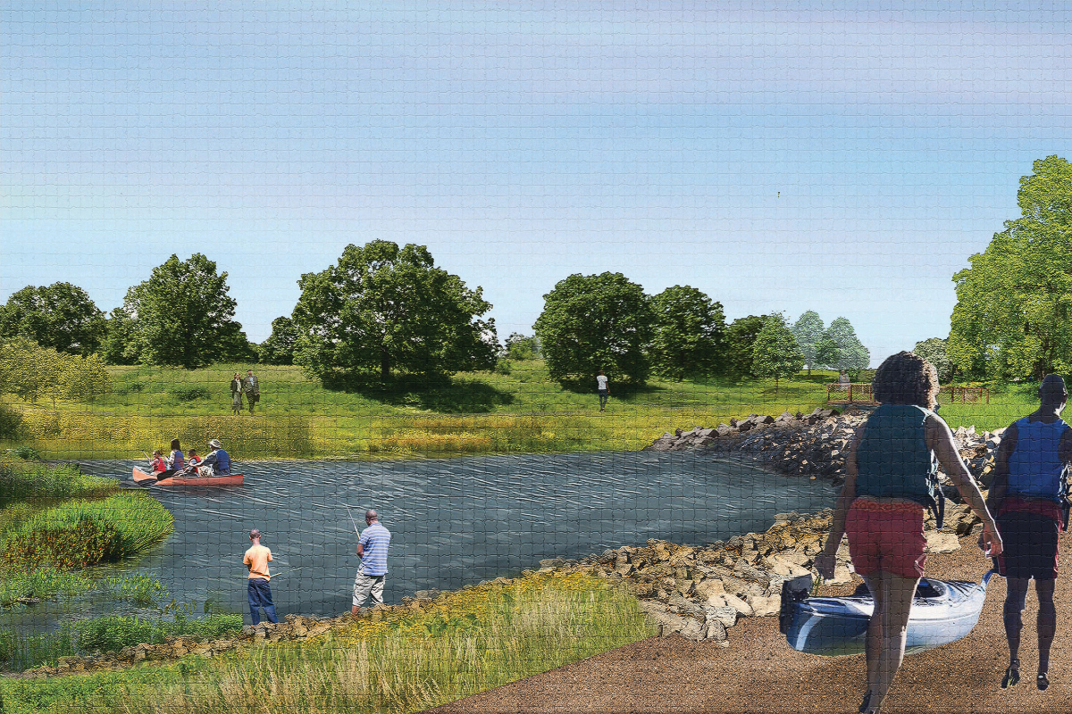
Robbins Stormwater Park represents the first major phase of that vision. By transforming gray drainage systems into a resilient public landscape, the park is designed to manage the 100-year storm while restoring ecological function and creating space for recreation, gathering, and long-term opportunity. I
Innovative engineering strategies are paired with thoughtful material reuse throughout the site. Stone excavated during the creation of new drainage features was repurposed to armor channel edges and shape a safe-water zone at the confluence with the Cal-Sag Channel, supporting kayaks, canoes, and other personal watercraft while reinforcing the site’s hydrologic performance.
The first stage of park construction north of Claire Boulevard was completed in 2023. Subsequent phases continue to advance the broader Vision for Robbins Master Plan. Future phases include the potential for an adjacent transit-oriented development district and an energy district, extending the project’s impact beyond flood protection to support long-term community resilience and economic vitality.
Rock led the design of this project and oversaw the construction of the first phase while at Living Habitats. That work reflects a commitment carried forward at RDA: designing infrastructure that delivers measurable performance, acknowledges history, and invests in communities that have too often been asked to absorb risk without receiving benefit.
The Vision for Robbins Master Plan responds to a long history of flooding and disinvestment in the Village of Robbins, a historically self-governed Black community located
within a low-lying floodplain south of Chicago. For decades, Robbins relied on infrastructure that could handle only modest rainfall. As storms grew heavier, flooding became a regular part of daily life.
Through a series of public meetings, collaboration with residents, and ongoing dialogue with local leadership, the planning team developed a vision that paired critical stormwater infrastructure with long-term community opportunity. The master plan leveraged green infrastructure to address flooding without displacing residents, while identifying future possibilities for transit-oriented development near the METRA station and an energy district along the Cal-Sag Channel.
Robbins Stormwater Park represents the first major phase of that vision. By transforming gray drainage systems into a resilient public landscape, the park is designed to manage the 100-year storm while restoring ecological function and creating space for recreation, gathering, and long-term opportunity. I
Innovative engineering strategies are paired with thoughtful material reuse throughout the site. Stone excavated during the creation of new drainage features was repurposed to armor channel edges and shape a safe-water zone at the confluence with the Cal-Sag Channel, supporting kayaks, canoes, and other personal watercraft while reinforcing the site’s hydrologic performance.
The first stage of park construction north of Claire Boulevard was completed in 2023. Subsequent phases continue to advance the broader Vision for Robbins Master Plan. Future phases include the potential for an adjacent transit-oriented development district and an energy district, extending the project’s impact beyond flood protection to support long-term community resilience and economic vitality.
Rock led the design of this project and oversaw the construction of the first phase while at Living Habitats. That work reflects a commitment carried forward at RDA: designing infrastructure that delivers measurable performance, acknowledges history, and invests in communities that have too often been asked to absorb risk without receiving benefit.
ARC Wildlife Crossing Competition Winner
West Vail Pass, Colorado

The ARC Wildlife Crossing Competition challenged designers to rethink how infrastructure could support both human mobility and ecological continuity. The winning proposal, hypar-nature, led by Rock while at Michael Van Valkenburgh Associates in collaboration with HNTB, approached this challenge by reversing a common assumption: the landscape was not designed for people, but for wildlife.
Sited at West Vail Pass along Colorado’s I-70 corridor, a significant barrier to movement in the Southern Rocky Mountains, the design focused on restoring habitat connectivity across a fragmented landscape. Rather than recreating nature, the proposal identified the region’s key habitat types—forest, meadow, shrubland, and rocky slopes—and carried them continuously across the structure so wildlife experiences the crossing as an extension of the land.
A modular system of precast concrete forms minimized site disturbance while enabling efficient construction, expansion, and adaptation to different locations and migration pressures. Conceived as a scalable prototype rather than a one-off solution, the project offered a new model for addressing habitat fragmentation at a regional scale.
Unanimously selected by an international jury, the project has since become a reference point in landscape architecture and road ecology education, helping shape the profession's understanding of wildlife crossings as essential, performance-driven infrastructure.
The ARC Wildlife Crossing Competition challenged designers to rethink how infrastructure could support both human mobility and ecological
continuity. The winning proposal, hypar-nature, led by Rock while at Michael Van Valkenburgh Associates in collaboration with HNTB, approached this challenge by reversing a common assumption: the landscape was not designed for people, but for wildlife.
Sited at West Vail Pass along Colorado’s I-70 corridor, a significant barrier to movement in the Southern Rocky Mountains, the design focused on restoring habitat connectivity across a fragmented landscape. Rather than recreating nature, the proposal identified the region’s key habitat types—forest, meadow, shrubland, and rocky slopes—and carried them continuously across the structure so wildlife experiences the crossing as an extension of the land.
A modular system of precast concrete forms minimized site disturbance while enabling efficient construction, expansion, and adaptation to different locations and migration pressures. Conceived as a scalable prototype rather than a one-off solution, the project offered a new model for addressing habitat fragmentation at a regional scale.
Unanimously selected by an international jury, the project has since become a reference point in landscape architecture and road ecology education, helping shape the profession's understanding of wildlife crossings as essential, performance-driven infrastructure.
Andlinger Center for Energy and the Environment
Princeton University, Princeton, NJ

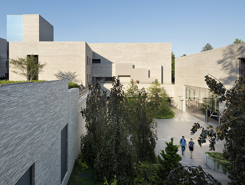
Completed during Rock’s time at Michael Van Valkenburgh Associates in Brooklyn, the Andlinger Center for Energy and the Environment is embedded within Princeton University’s Engineering Quad as both a place of advanced research and a connective landscape that bridges scales, disciplines, and daily campus life.
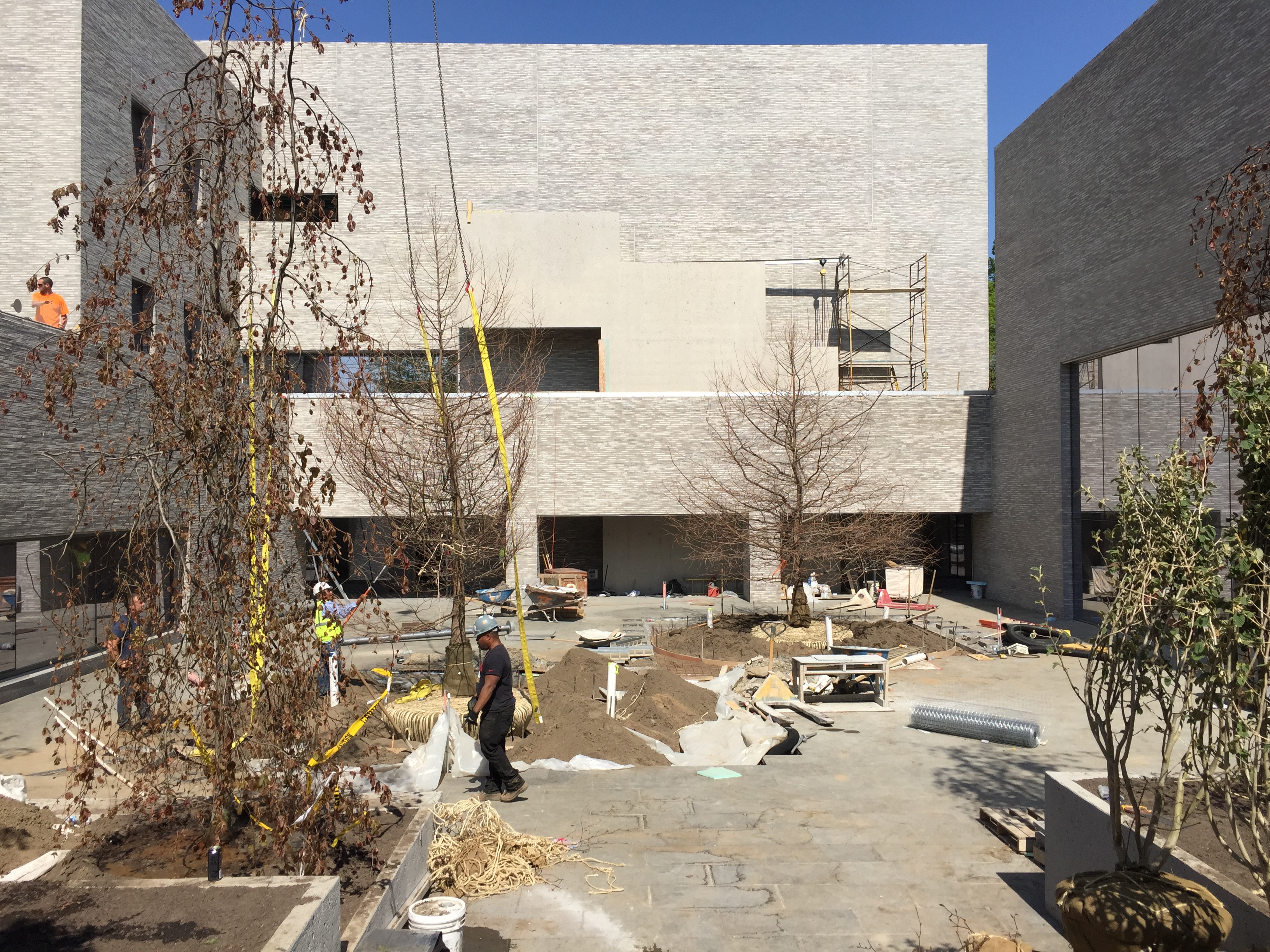
Designed through a close collaboration between Tod Williams Billie Tsien Architects and Michael Van Valkenburgh Associates, the project carefully mediates between the larger institutional fabric of the Engineering Quad and the finer-grained residential context of Prospect Street. Rather than presenting a single mass, the building is composed of a series of interrelated volumes, woven together with gardens at multiple levels, allowing architecture and landscape to function as a unified system.
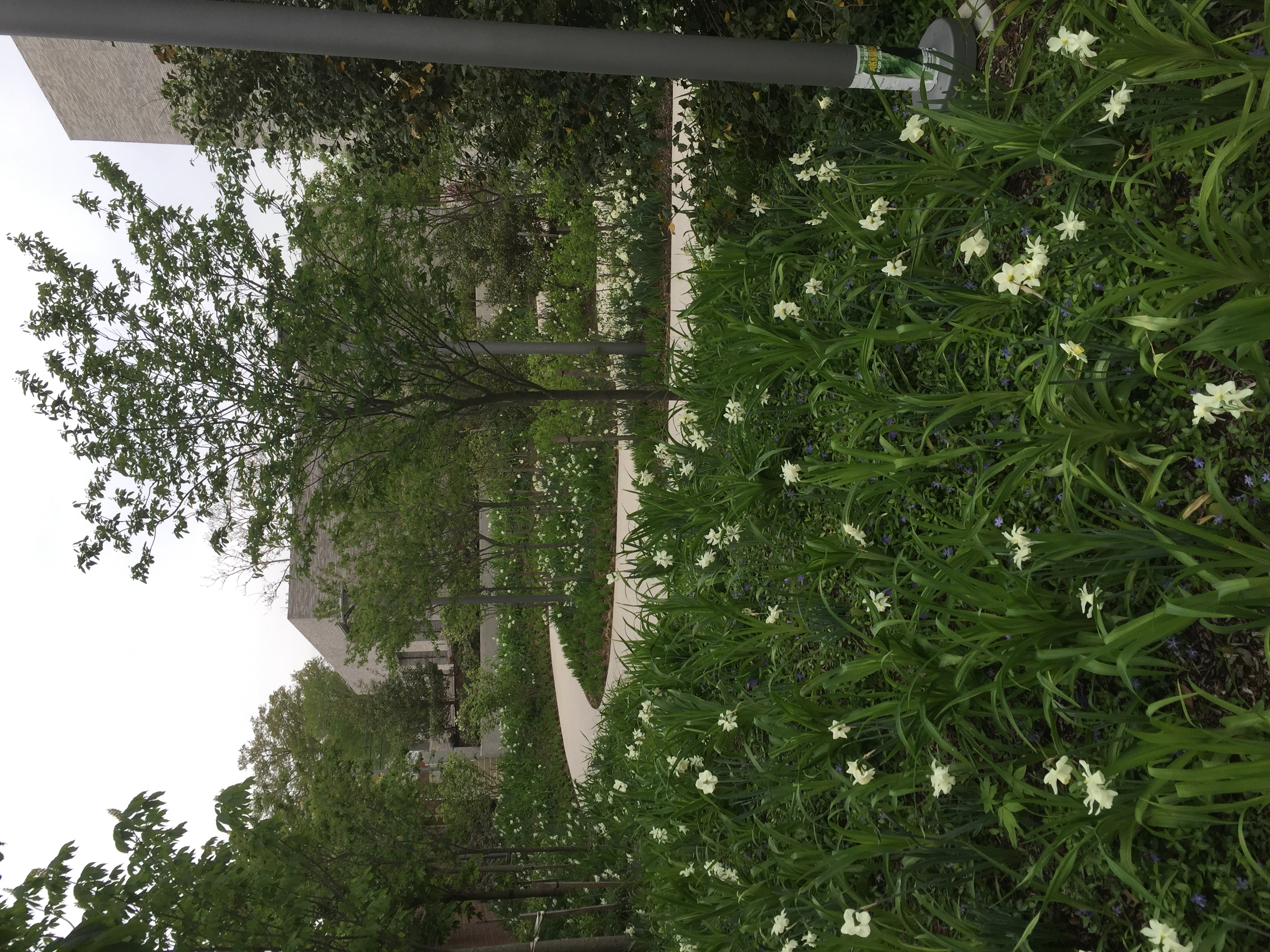
Much of the program is situated below grade, where sunken gardens bring daylight, weather, and vegetation into laboratories, classrooms, and workspaces that would otherwise be inward-looking. These gardens provide spaces for quiet reflection and informal gathering, extend major pedestrian paths, and invite the broader campus community into the heart of the project. Green roofs planted with native species further reinforce the sensory and ecological continuity of the landscape.
Together, the architecture and landscape create an environment that supports interdisciplinary collaboration while modeling a thoughtful response to sustainability, scale, and place.
Completed during Rock’s time at Michael Van Valkenburgh Associates in Brooklyn, the Andlinger Center for Energy and the
Environment is embedded within Princeton University’s Engineering Quad as both a place of advanced research and a connective landscape that bridges scales, disciplines, and daily campus life.
Designed through a close collaboration between Tod Williams Billie Tsien Architects and Michael Van Valkenburgh Associates, the project carefully mediates between the larger institutional fabric of the Engineering Quad and the finer-grained residential context of Prospect Street. Rather than presenting a single mass, the building is composed of a series of interrelated volumes, woven together with gardens at multiple levels, allowing architecture and landscape to function as a unified system.
Much of the program is situated below grade, where sunken gardens bring daylight, weather, and vegetation into laboratories, classrooms, and workspaces that would otherwise be inward-looking. These gardens provide spaces for quiet reflection and informal gathering, extend major pedestrian paths, and invite the broader campus community into the heart of the project. Green roofs planted with native species further reinforce the sensory and ecological continuity of the landscape.
Together, the architecture and landscape create an environment that supports interdisciplinary collaboration while modeling a thoughtful response to sustainability, scale, and place.
TEARDROP
PARK SOUTH
New York, NY

Teardrop Park South is a compact public landscape designed to support a wide range of everyday use. Conceived as a continuation of Teardrop Park in Battery Park City, the project is organized through bluestone walls, water features, landform, and planting that create distinct zones for activity and rest.
The park accommodates users of many ages through carefully scaled spaces that balance openness and enclosure. Areas for water and sand play sit alongside lawns, seating, and quieter garden spaces, allowing different uses to coexist within an intimate setting.
Built atop a two-story parking structure, the park integrates stormwater capture and recirculating water systems that support its water features and reduce reliance on potable water. Rock oversaw the project's construction while at Michael Van Valkenburgh Associates, helping translate the design intent into a durable, well-used public space.
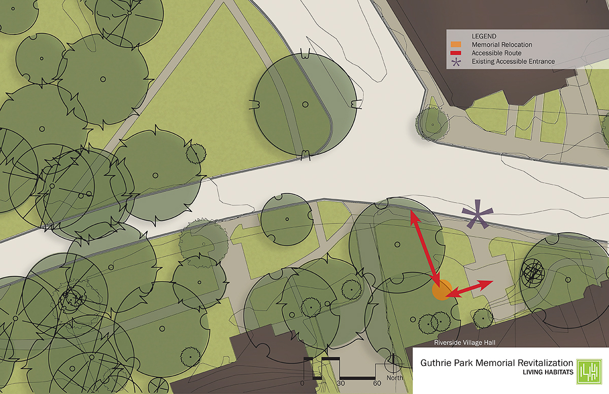
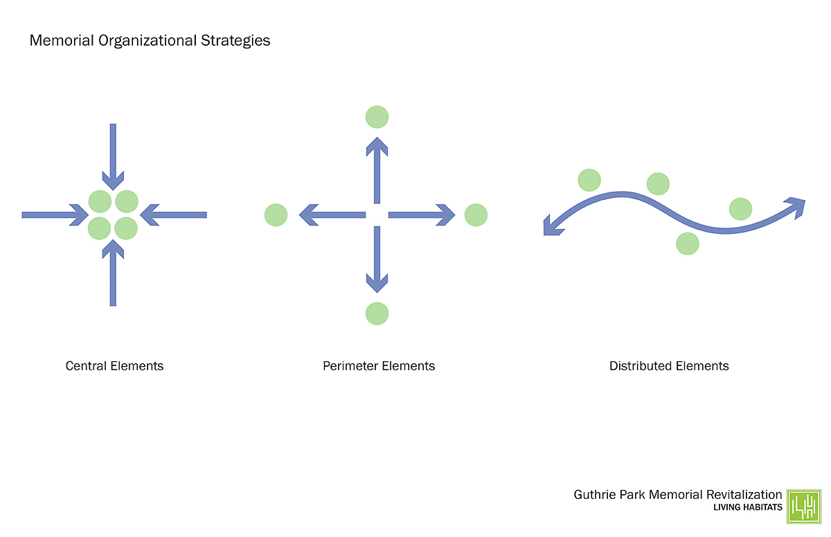
GUTHRIE MEMORIAL REVITALIZATION
Riverside, Illinois
This thoughtful and deliberate analysis of alternatives for the revitalization of Riverside’s Veteran’s Memorial, located within the heart of the Village, was completed by Rock while at Living Habitats. Conceptual design studies followed a thoughtful site analysis exercise and examined the scale, visitor access, and possible locations to honor the lives of the fallen. The materials prepared in this initial visioning process were crafted to enable the Village with flexible alternatives as they looked to build additional support for the project and identify funding sources. This conceptual study was directed by Rock while at Living Habitats.
This thoughtful and deliberate analysis of alternatives for the revitalization of Riverside’s Veteran’s Memorial, located within the heart of the Village, was completed by Rock while at Living Habitats. Conceptual design studies followed a thoughtful site analysis exercise and examined the scale, visitor access, and possible locations to honor the lives of the fallen. The materials prepared in this initial visioning process were crafted to enable the Village with flexible alternatives as they looked to build additional support for the project and identify funding sources. This conceptual study was directed by Rock while at Living Habitats.
CANMORE WILDLIFE CROSSING STUDY
Canmore, Alberta, Canada

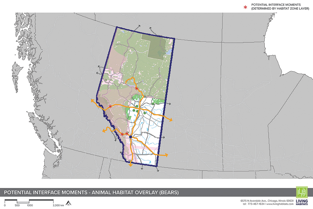
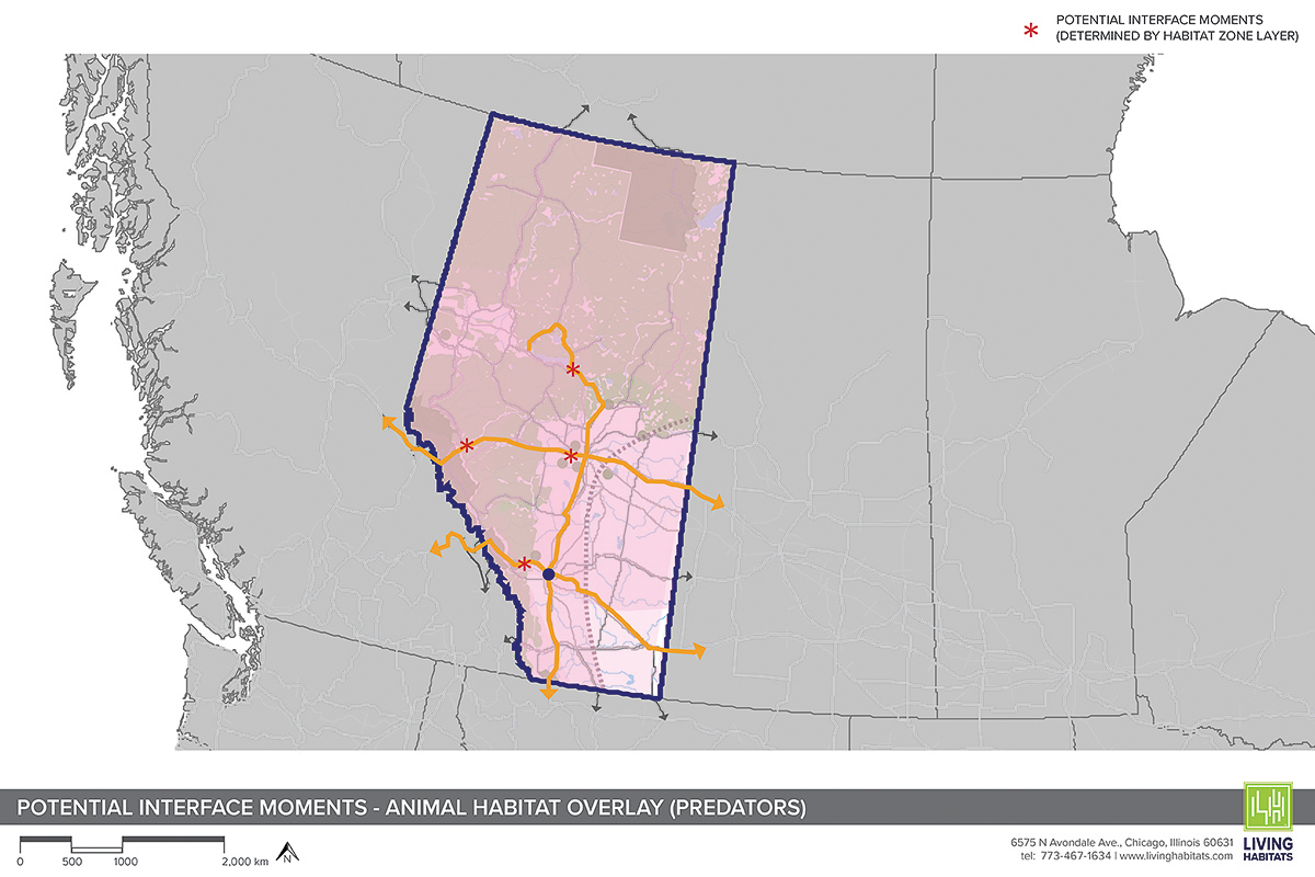
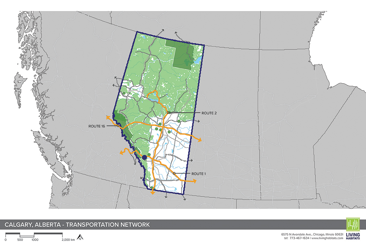
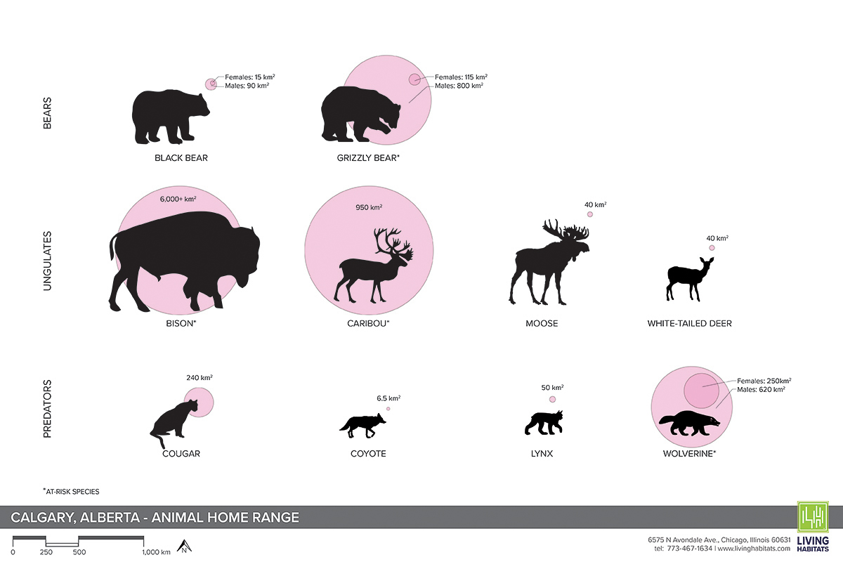
The landscapes surrounding Canmore, Alberta, form one of the most ecologically significant wildlife corridors in North America, linking the Rocky Mountains beyond Banff National Park to the broader Yellowstone to Yukon region. In this setting, the Trans-Canada Highway serves both as a vital transportation route and a significant barrier to wildlife movement, fragmenting habitats that once functioned as continuous systems.
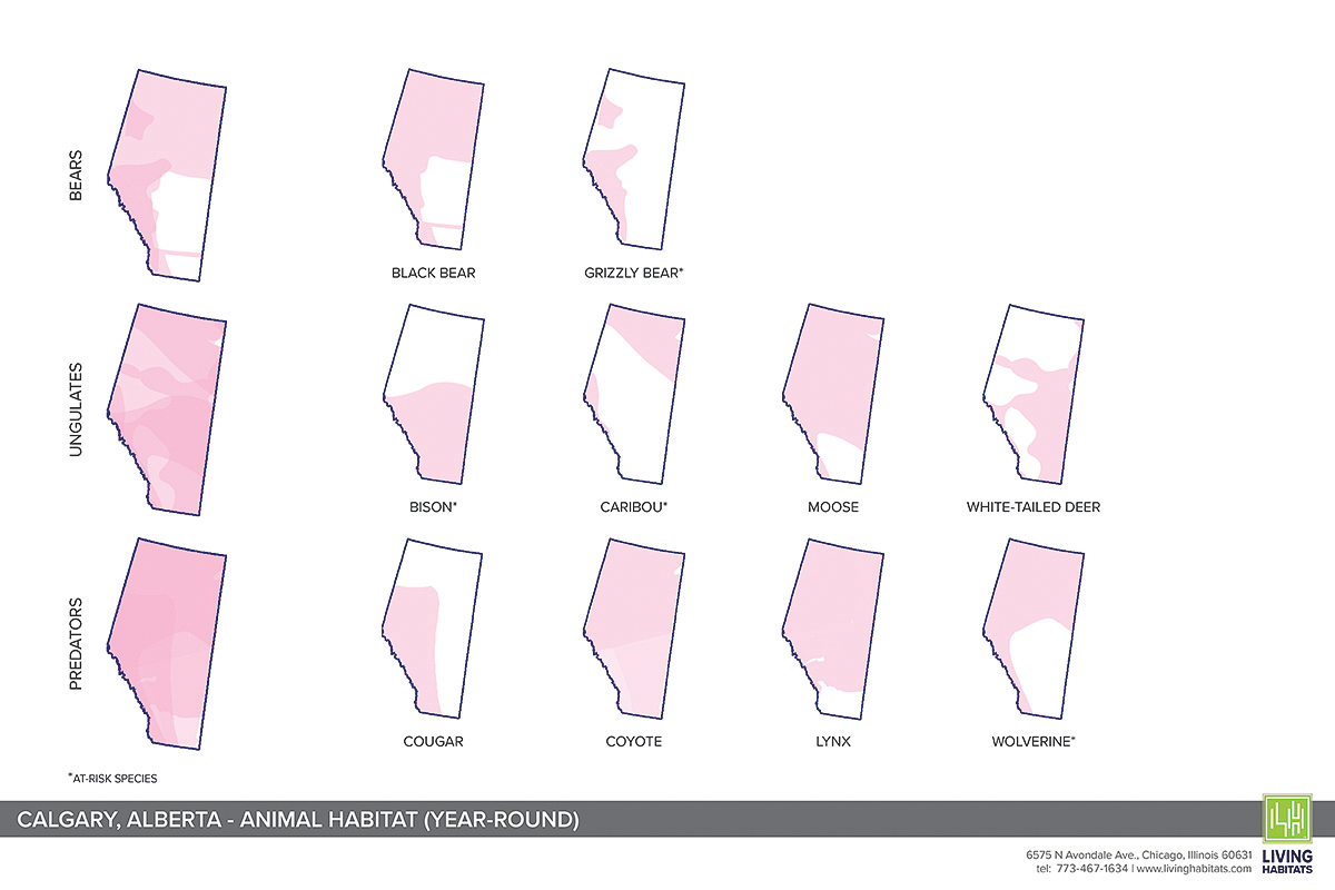
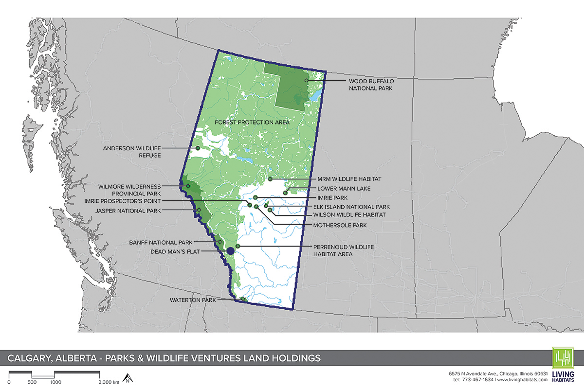
Working in collaboration with the Yellowstone to Yukon Conservation Initiative, Rock directed a conceptual study focused on improving wildlife connectivity in the Bow Valley just east of Banff National Park. The study brought together wildlife biologists, conservation specialists, and key stakeholders to better understand how at-risk and keystone species move through the landscape, and where strategic interventions could most effectively reduce fragmentation.
Through a series of meetings, site analyses, and design explorations conducted over several months, the team identified potential locations for wildlife crossing structures and habitat restoration. Rather than proposing a single solution, the study established a framework for prioritizing future investment, recognizing that meaningful connectivity requires long-term coordination between science, infrastructure, and land management.
Completed while at Living Habitats, this work reflects an approach that treats wildlife crossings not as isolated projects, but as part of a broader, landscape-scale effort to reconnect ecological systems while accommodating human mobility.
The landscapes surrounding Canmore, Alberta, form one of the most ecologically significant wildlife corridors in North America, linking the Rocky Mountains beyond Banff National Park to the broader Yellowstone to Yukon region. In this setting, the Trans-Canada Highway serves both as a vital transportation route and a significant barrier to wildlife movement, fragmenting habitats that once functioned as continuous systems.
Working in collaboration with the Yellowstone to Yukon Conservation Initiative, Rock directed a conceptual study focused on improving wildlife connectivity in the Bow Valley just east of Banff National Park. The study brought together wildlife biologists, conservation specialists, and key stakeholders to better understand how at-risk and keystone species move through the landscape, and where strategic interventions could most effectively reduce fragmentation.
Through a series of meetings, site analyses, and design explorations conducted over several months, the team identified potential locations for wildlife crossing structures and habitat restoration. Rather than proposing a single solution, the study established a framework for prioritizing future investment, recognizing that meaningful connectivity requires long-term coordination between science, infrastructure, and land management.
Completed while at Living Habitats, this work reflects an approach that treats wildlife crossings not as isolated projects, but as part of a broader, landscape-scale effort to reconnect ecological systems while accommodating human mobility.
SWAN POND RESTORATION
Riverside, Illinois

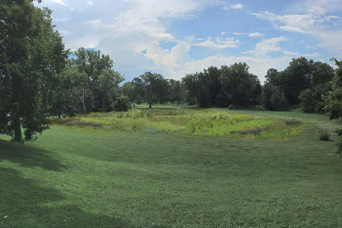
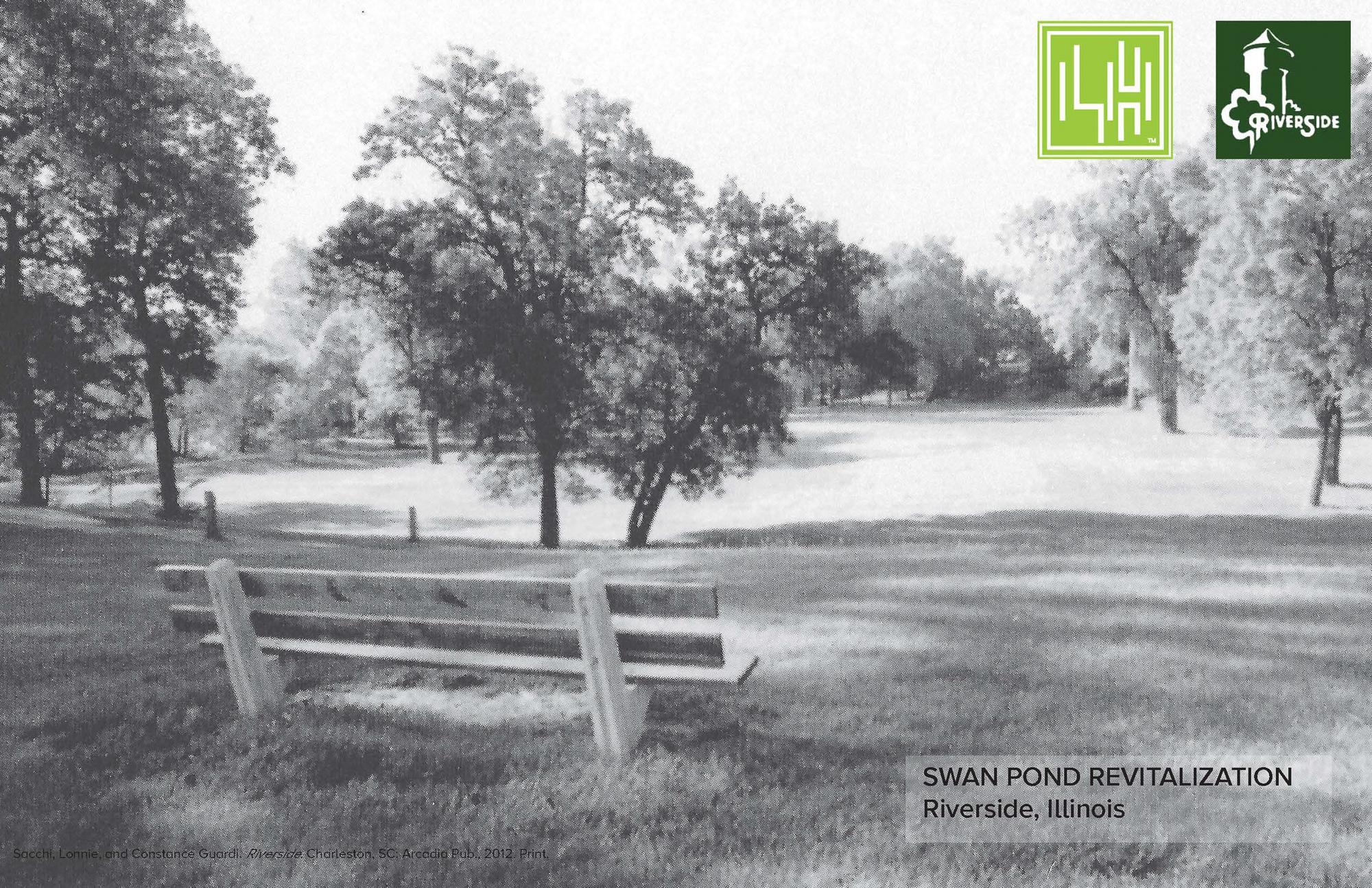
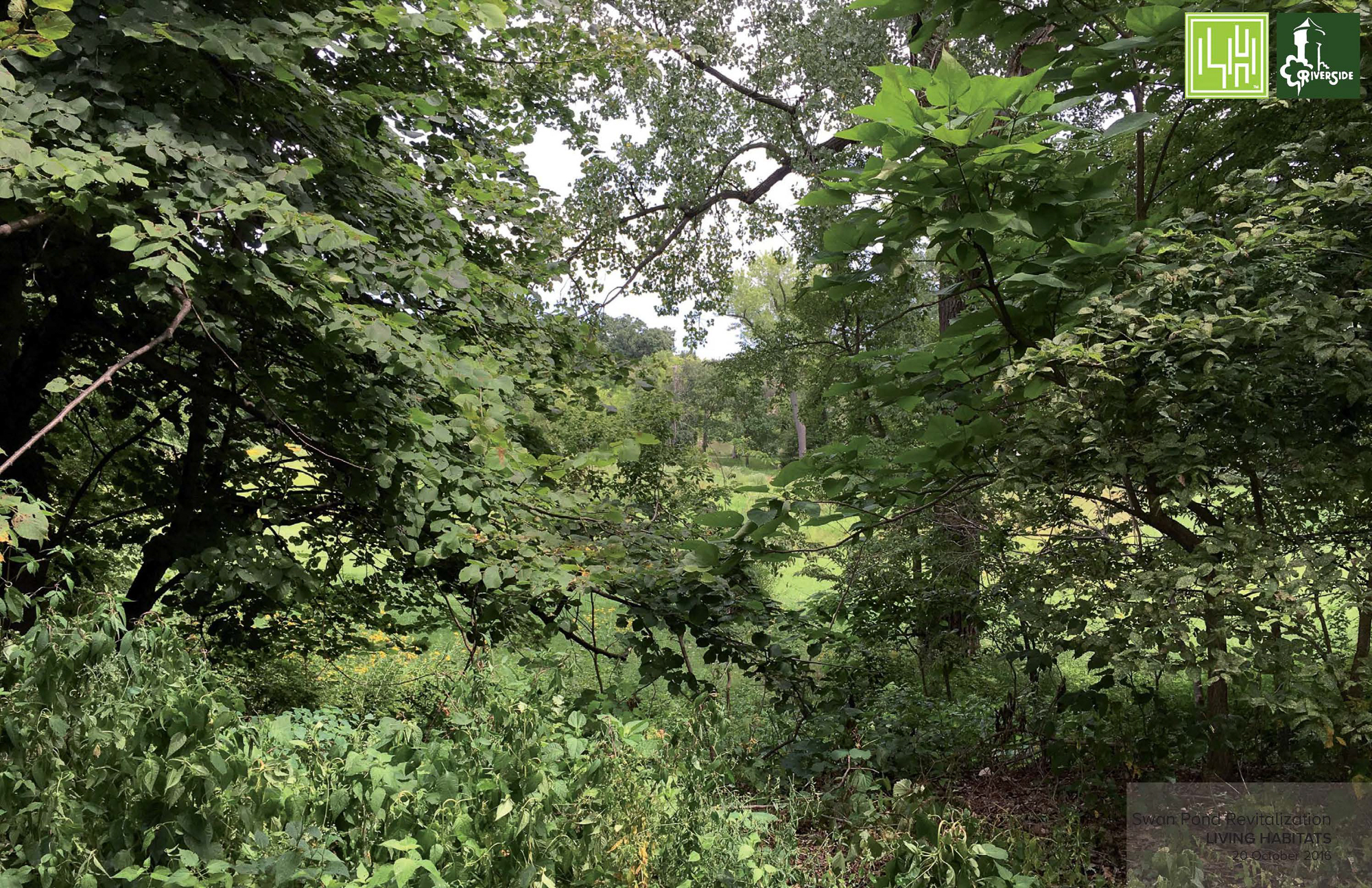
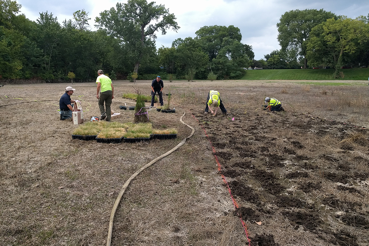
Swan Pond once played a central role in Frederick Law Olmsted’s design for the Village of Riverside, occupying a prominent location along the Des Plaines River within a naturally forming floodplain. Shaped by a bend in the river, the landscape historically included multiple ponds and a surrounding creek that created an island known locally as Picnic Island. Over time, changing perceptions of safety and use led to the gradual filling of the creek and the loss of much of the pond’s original form.
This conceptual study began with extensive research into Olmsted’s original intent, historic site uses, and the cumulative impacts of landscape modification over more than a century. While full reconstruction of the original pond was no longer feasible, the work focused on identifying ways to recover the spirit and spatial clarity of the design within contemporary constraints.
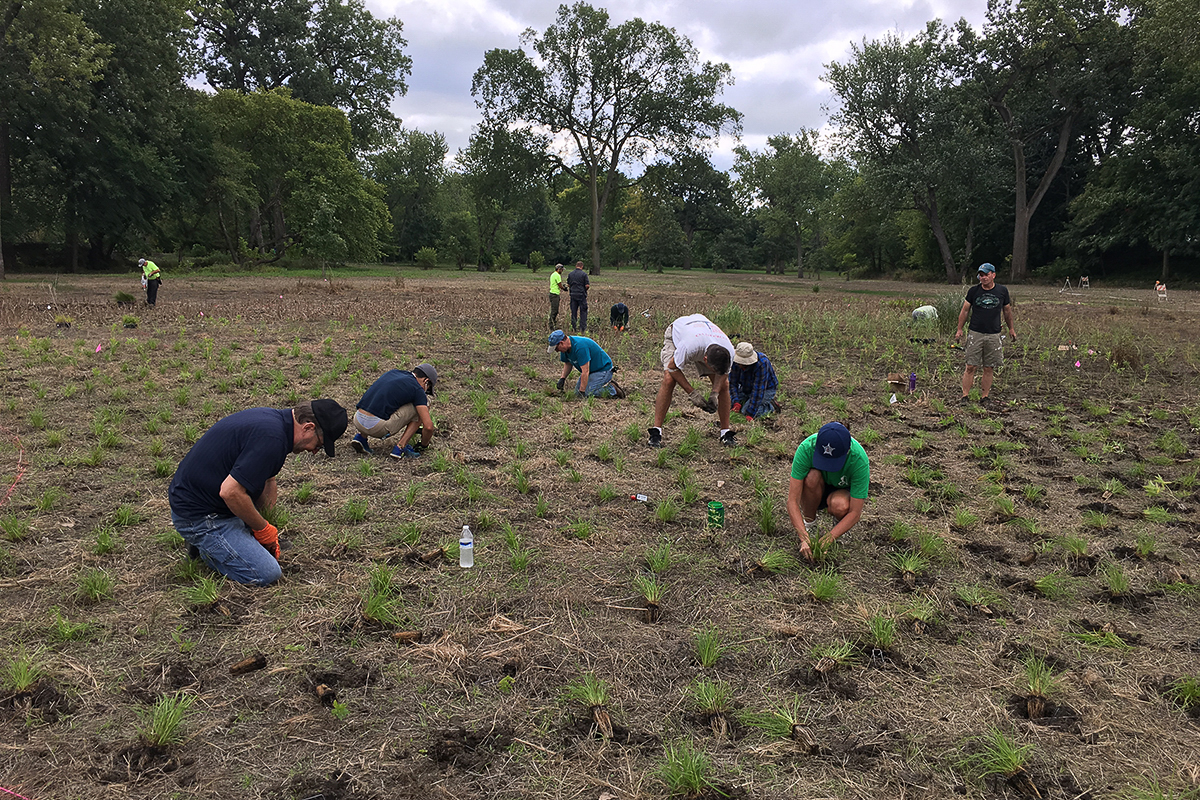
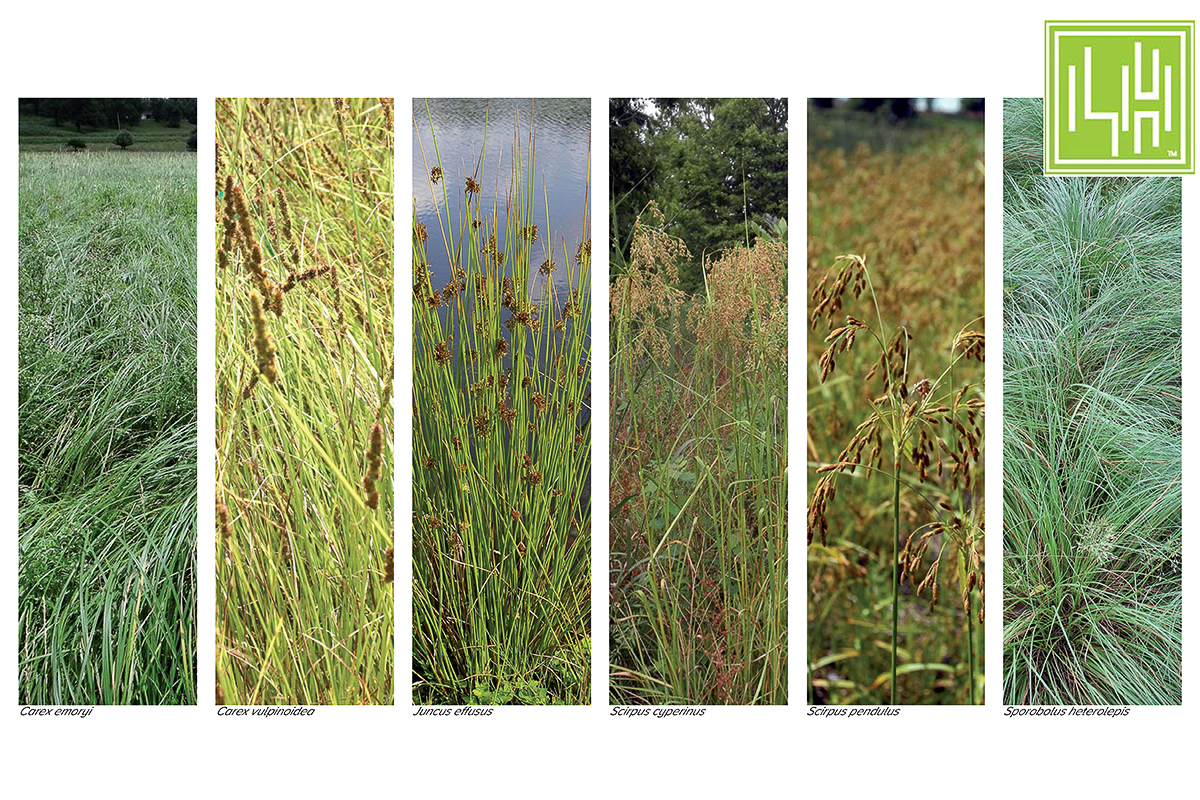
Recommendations emphasized restoring planting areas, revitalizing WPA-era site elements, and carefully reestablishing views and vistas that once defined the park’s relationship to the river. Today, the site continues to be used by birds and other wildlife associated with the Des Plaines River and surrounding tree canopy.
The original design concepts, research, and site strategies were completed by Rock while at Living Habitats, reflecting an approach to historic landscapes grounded in research, restraint, and respect for place.
Swan Pond once played a central role in Frederick Law Olmsted’s design for the Village of Riverside, occupying a prominent location along the Des Plaines River within a naturally forming floodplain. Shaped by a bend in the river, the landscape historically included multiple ponds and a surrounding creek that created an island known locally as Picnic Island. Over time, changing perceptions of safety and use led to the gradual filling of the creek and the loss of much of the pond’s original form.
This conceptual study began with extensive research into Olmsted’s original intent, historic site uses, and the cumulative impacts of landscape modification over more than a century. While full reconstruction of the original pond was no longer feasible, the work focused on identifying ways to recover the spirit and spatial clarity of the design within contemporary constraints.
Recommendations emphasized restoring planting areas, revitalizing WPA-era site elements, and carefully reestablishing views and vistas that once defined the park’s relationship to the river. Today, the site continues to be used by birds and other wildlife associated with the Des Plaines River and surrounding tree canopy.
The original design concepts, research, and site strategies were completed by Rock while at Living Habitats, reflecting an approach to historic landscapes grounded in research, restraint, and respect for place.
VILLAGE HALL LANDSCAPE REVITALIZATION
Bannockburn, Illinois

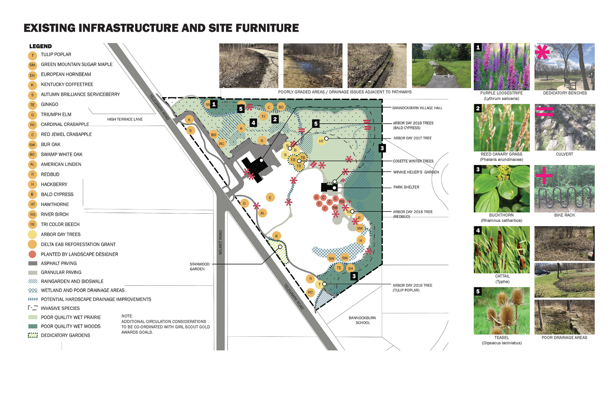
Like many communities across the Midwest, Bannockburn has experienced widespread canopy loss due to the Emerald Ash Borer. In a short period, once continuous woodlands were significantly altered, leaving significant gaps in the tree canopy around key civic spaces, including the area surrounding Village Hall. As ash trees declined, invasive species such as buckthorn spread into these disturbed areas, limiting native woodland species' ability to regenerate naturally.
This planning study was initiated to help the Village understand the scope of that transformation and chart a path forward. Through discussions with Village staff and elected officials, the work identified shared priorities for restoring canopy health, improving ecological resilience, and guiding future stewardship of public land. Those priorities informed a set of potential strategies and helped pinpoint locations where targeted interventions could have the most tremendous impact.
By establishing a clear framework for action, the study provided the Village with a roadmap to align existing resources, plan phased restoration efforts, and direct future investment toward rebuilding a healthy, resilient canopy over time.
This project was completed by Rock while at Living Habitats.
Center for The Arts at University of Illinois Chicago
Chicago, Illinois

Village Hall Landscape Revitalization
Bannockburn, Illinois
Like many communities in the Midwest and elsewhere, the damage from the Emerald Ash Borer is significant, quickly transforming sprawling woodlands into veritable graveyards for these once-staples of the canopy. Much of this transformation in the areas around the Village Hall in Bannockburn has resulted in other invasive species like Buckthorn making their way into previously wooded areas and choking out the native woodland species that might fill the void. In an effort to provide a road map for the restoration and rebuild of this critical canopy in the public space, a series of priorities where identified through discussion with Village staff and elected officials which then informed potential strategies for achieving them. By identifying possible locations for strategic interventions this planning study allowed the Village a framework to utilize existing resources and target future investments.
This project was completed by Rock while at Living Habitats.
Bird Friendly Plants of the Chicago Region
Chicago, Illinois

This useful reference graphic highlights several bird species that frequent the Chicago region and the plants that serve as habitat for them, highlighting six different plant features that are key in the relationship between plant and animal. Initially used to support dialogue with a local community group several years ago, this graphic has been used in a number of additional meetings and presentations to highlight how important it is to create accessible communication tools.
The creation of this communication graphic was directed by Rock while at Living Habitats.